We bring a broad range of experience to your project specializing in mining, exploration, permafrost, hydro-geophysics, aggregates, oil sands, and geological hazard identification.

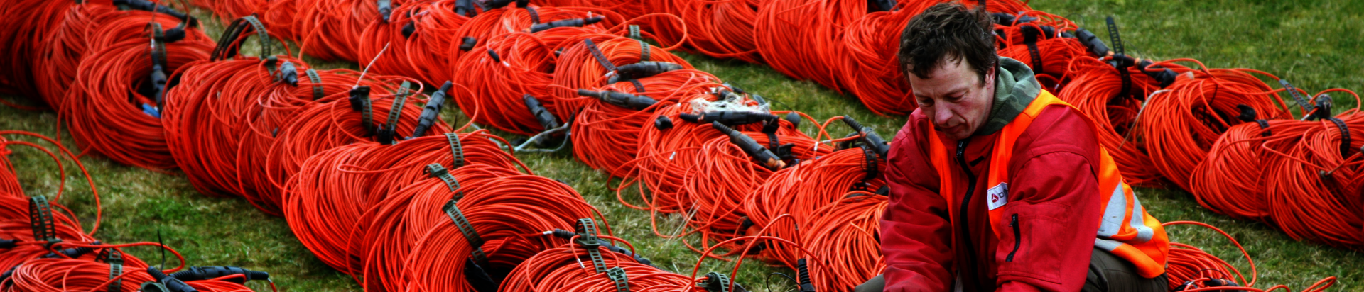
DMT has extensive experience in exploration and mining geophysics. Surveys have been conducted in environments ranging from the jungles of Africa to the high Andes in Peru, and from the Canadian Arctic to the South Pacific. DMT Geosciences has employed nearly every geophysical method available to address a wide variety of exploration and mining related project objectives.
DMT has a specialisation in the support of risk management regarding structures such as tailings dams and studies for environmental impact. We as an organization are dedicated to providing thorough and professional analysis, advice, data acquisition and results to maximize the effectiveness of geophysics in exploration and mining projects to minimize risk posed by geological hazards.
Because our expertise spans a wide range of geophysical methods and we have experience with these methods in a variety of geological settings, we can bring unique solutions to complicated problems using carefully designed and collected multi-method geophysical surveys.
Exploration
| Mining
| Mining Hazards/Risk assessment
|
CASE STUDIES: Please click project name for for more details
LOCATION: Mount Polley Mine, Canada
OBJECTIVES: Evaluate the use of geophysics in tailings dam construction. DMT was consulted as an expert on geophysics during the Mount Polley Independent Expert Engineering Investigation and Review Panel at the recommendation of Panel Chair Dr. Norbert Morgenstern, P.Eng
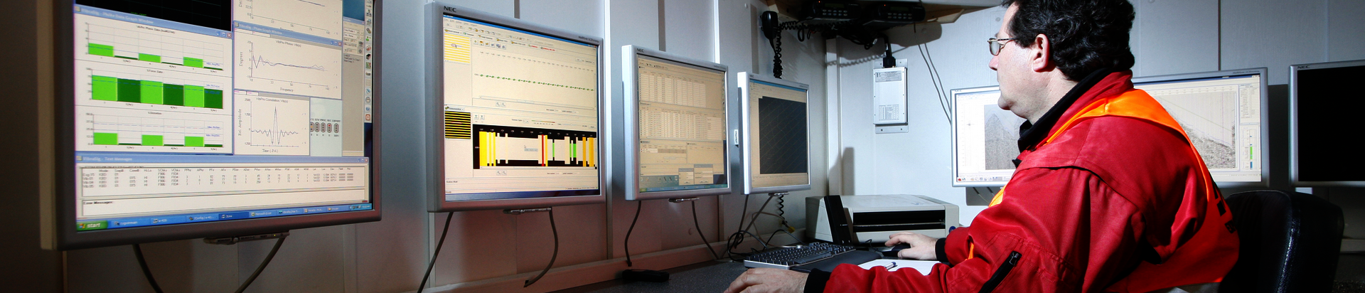
DMT Geosciences has extensive experience in geophysical investigations for geotechnical engineering applications using surface and borehole geophysical methods.
We offer many types of geotechnical testing for site investigations. Our engineers cover groundwater surveys, analyses of rock and soil conditions, feasibility studies and consulting for your geotechnical project. We combine several geotechnical testing methods to be able to gather complimentary data to deliver an analysis suitable for your needs.
CASE STUDIES:
FLOOD MITIGATION FEASIBILITY STUDY IN THE HIGHWOOD RIVER BASIN
LOCATION: High River, Alberta
OBJECTIVES: Using a combination of seismic and ground resistivity surveys to identify and measure the thickness of coarse-grained sediments and determine the depth to bedrock.
DYRGAS GATE SINKHOLE MITIGATION
LOCATION: Canmore, Alberta
OBJECTIVES: Locate an airshaft from abandoned coal workings causing the sinkhole to form.
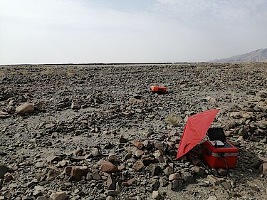
Environmental geophysics is one of DMT Geosciences' core areas of expertise. We have extensive experience collecting and interpreting environmental data. We work closely with our clients to integrate soil and water chemistry data with our geophysical data to provide a more thorough interpretation.
DMT has developed an alternative approach to environmental geophysics called Rapid Conductivity Volume (RCV). With this method we provide a pseudo 3-D image of the subsurface contaminants. With a more sophisticated approach and a team of Professional Geophysicists, DMT strives to provide our clients with data that has advantages over traditional EM methods.
The advantage of DMT's approach:
Applications:
CASE STUDIES:
RCV PROJECT FOR VOLUMETRIC ANALYSIS OF SALT IMPACT.
Location: Southern Alberta
Objective: delineating impacted zone of high TDS spill for improved efficiency in remediation.
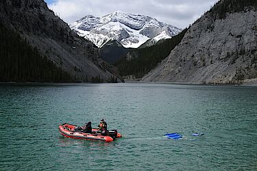
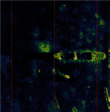
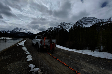
Bodies of water present a challenging environment to acquire data for site characterization. At DMT, we provide a broad range of water-borne geophysical surveys that help to provide information where other forms of data acquisition are limited. Surveys are customized to ensure that they meet the specific needs of the projects.
CASE STUDIES:
SURVEY TO MAP SEDIMENT AND BEDROCK FOR CIVIL ENGINEERING PROJECT
Location: Lillooet Lake, BC
Objectives: Map the bedrock surface and layering in the water-bottom sediments.
MARINE SURVEY FOR HAZARD MAPPING
Location: False Creek, BC
Objectives: Map the location of hazards at the bottom of False Creek.
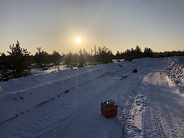
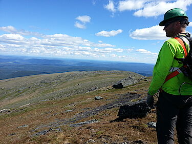
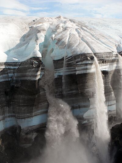
DMT Geosciences has extensive experience working in Northern environments. There are unique challenges working in the north including the presence of permafrost and muskeg. With the warming climate, such studies are increasingly relevant. Geophysics provides non-invasive method to investigate in environmentally sensitive areas where drilling and other methods may lead to permafrost degradation.
Applications:
CASE STUDIES:
PERMAFROST MAPPING FOR DYKE EXPANSION PROJECT
LOCATION: Northwest Territories, Canada
OBJECTIVES: Identifying variations in ice content, soil type, permafrost extent, depth to bedrock, and taliks.
RISK MANAGEMENT: MAPPING PERMAFROST AND SINKHOLES ALONG THE DEMPSTER AND CAMPBELL HIGHWAYS
LOCATION: Yukon, Canada
OBJECTIVES: Identify sinkholes, ice-rich permafrost and underlying factors contributing to permafrost
degradation and sinkhole development.
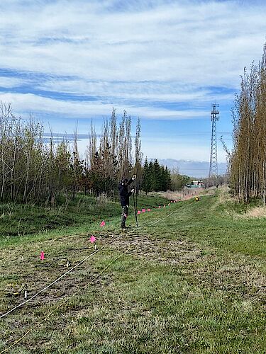
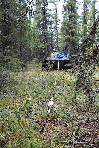
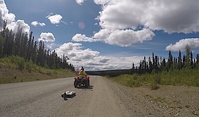
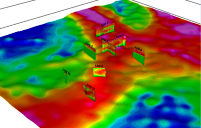
DMT specializes in geophysical solutions for transportation corridor design and monitoring including roads, railways, power lines and pipelines. Typical geophysical methods used are: Ground penetrating radar, DC-resistivity, electromagnetics and refraction/reflection seismic each providing different rock and soil properties and depths of investigation.
Carefully designed and collected multi-method geophysical surveys can be used to measure the thickness of sediments above bedrock and to provide detailed fault mapping and stratigraphic information. It is also possible to differentiate fractured, weathered low RQD bedrock from competent bedrock and in some case differentiate certain rock types. Typical geophysical methods used are: Ground penetrating radar, DC-resistivity, electromagnetics and refraction/reflection seismic each providing different rock properties and depths of investigation.
In combination with strategically placed boreholes, geophysical methods offer a more continuous view of the subsurface than boreholes alone, with little or no environmental impact.
Electrical, electromagnetic, ground penetrating radar and refraction/reflection seismic methods are used in specific combinations to map rock properties at the required depths along HDD crossings.
Interpretive cross sections are provided showing the distribution of sand, gravel and boulder horizons, identifying aquifers and infilled collapse features as well as profiling the bedrock surface, within the limitations of geophysical investigation.
CASE STUDIES:
RESISTIVITY FOR AGGREGATE DELINEATION
LOCATION: Central Alberta
OBJECTIVES: to delineate a gravel deposit and prospect for further resources in the lease area.
Central Alberta Aggregate Study
GPR FOR PIPELINE BUOYANCY CONTROL
LOCATION: Northeastern Alberta
OBJECTIVES: To reduce costs in the design, procurement and construction of a pipeline through delination of muskeg depths.
An Integrated Approach to Pipeline Buoyancy Control
DMT Geosciences specializes in geophysical investigations for groundwater using data from ground and airborne geophysical methods including: EM, resistivity/IP, seismic, magnetics, and gravity gradiometry.
Applications:
CASE STUDIES:
GROUNDWATER INVESTIGATION - MAPPING PALEO-CHANNELS IN NORTHERN ALBERTA
LOCATION: North-East Alberta, Athabasca Oil Sands
OBJECTIVES: Using multiple geophysical methods to study incised valley systems, inter-till paleochannels, deep saline aquifers and bedrock structure for regional groundwater exploration, Devonian geoscience studies, mine inundation risk analysis and protection of potable water supplies.

Suite 415, 708 11th Ave. SW
Calgary, Alberta
Canada T2R 0E4
T: 403.264.9496
F: 403.263.7641
canada(at)dmt-group.LÖSCHEN.com
Suite 1300, 1500 West Georgia Street
Vancouver, British Columbia
Canada V6G 2Z6
T: 604.293.2800
F: 604.801.5015
canada(at)dmt-group.LÖSCHEN.com